
Your shopping cart is empty!
Categories
Plat/Directory Books
Directory Maps
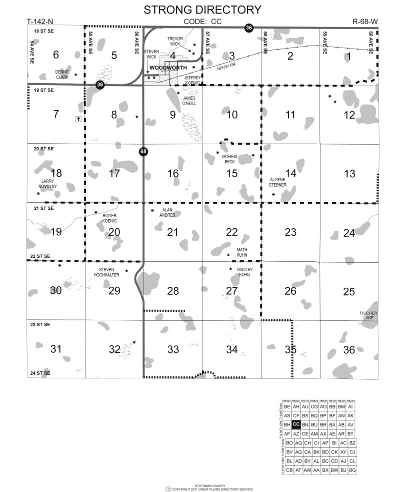
Directory maps show the current residents of each farmstead as well as the types of roads, locations of river, railroads, lakes and other geographic locations within the township. Types of roads and numbers of federal, state and some county roads are as shown in the “Legends” section. Farmsteads with livable buildings are indicated with an asterisk (*) and the name of the current resident is listed next to the asterisk. If there are too many names to be listed by the farmstead, the area is shaded.
Click on map image to view a larger version.
Plat Maps
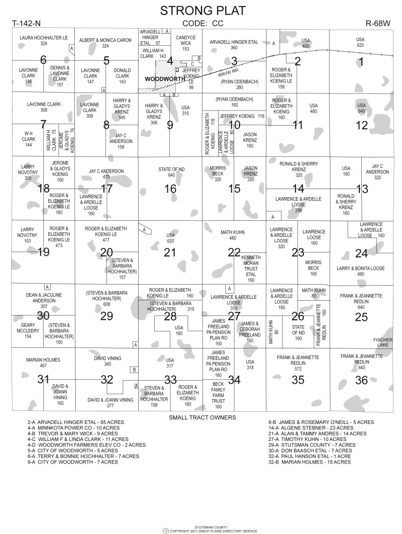
Plat maps show land ownership of each section in the township. The borders of each plat are shown with the owner’s name and acreage within those borders. If more than one owner is shown on the tax records, the first name listed is normally used followed by ETAL (meaning “and others”.) Land being purchased on a Contract for Deed will show the purchaser’s name in parenthesis if available. If space permits the original owner’s name will be listed. Plats of less than 40 acres are normally listed with a capital letter in the plat areas and a listing on the bottom of the page with the owner’s name and number of acres following the section number and identifying letter.
Click on map image to view a larger version.
Available features in all County Plat Books and Directories:
-
Directory Maps Showing:
- Current residents at each occupied farmstead
- Types of roads, paved, gravel or drained & graded
-
Plat Maps Showing:
- Land Owners for each parcel of rural land
- Federal and State owned land boundaries
-
Instructions on using the Plat Book & Directory:
- How to use the directories of rural residents and land owners
- How to read both the plat and directory maps
- Describes each of the symbols used in the provided key and legend
-
Also Includes:
- County reference map in center of book shows county roads, farmstead locations and 911 streets and avenues
- Alphabetical directory of rural residents which includes current address and phone numbers if available
- Alphabetical listing of land owners, which shows each section of land that the individual owns
- Location of railroads, rivers, creeks, and lakes within the township
- Description of Land Survey System and how township boundaries are determined
- History of the towns in the county
- Directory listing of progressive businesses in communities who help support publication of the Plat Books & Directories
For information on shape files contact our office.